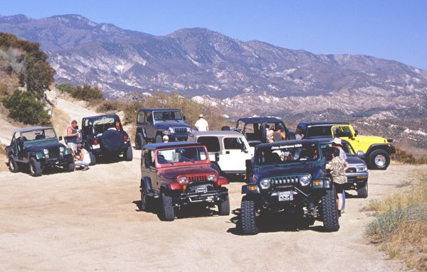
This was one of the most exciting Southern California runs ever. Some of the
Clark's customers seeing the pictures in his shop had been asking, when he would
take them Jeeping. This run was their chance to experience the thrill of four
wheeling first hand. MrBlain invited the TObject team to join friends from the
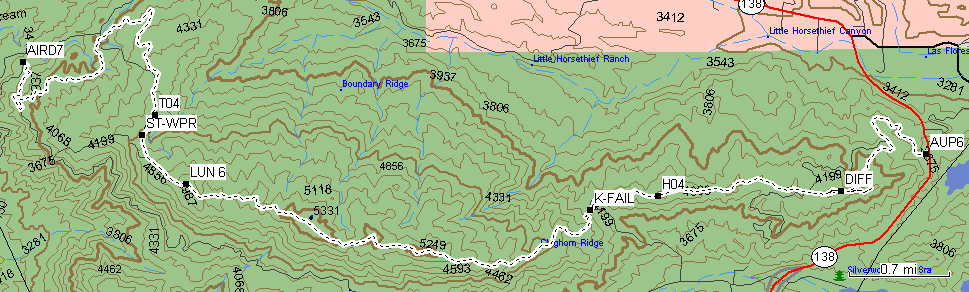
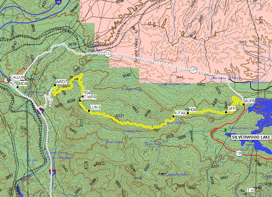
North. Below, you'll fined the map of the Cleghorn Trail, which is located off
of the interstate 15 in the middle of the Cajun Pass. This trail consists of
the main road, and lots of little fire roads. Those little fire roads looming
with interesting stretches and breathtaking obstacles. The main road slaves
as the bypass. Surface mostly consists off washed out dirt with a little bit
of rocks here and there.
|
MD4 N34
18.531 W117 28.175
CAJJUN N34 18.707
W117 28.475
|
The meeting place (MD4) was
set to 8am, near MacDonalds on the East side of I-15. This place is easy
to find, just watch for Chevron and MacDonalds transparents. If you are
driving I-15 take Hwy. 138 exit, also known as Cajun Junction (CAJJUN). |
|
AIRD7 N34
18.585 W117 26.860
|
The yellow TJ with 33' GY mud tires was the last one to show
up, and at about 9am we departed from the meeting place, and drove about
1.5 miles South I-15, then drove off the freeway to proceed another three
miles up the dirt road to the Air
Down Lot . All I had to do on my little TJ was, to disconnect the anti-sway
bar (I have JKS links). The trail warriors let the air off their giant tires.
It looked like they were getting ready to conquer the Everest mountain (I
think that mountan was fifteen miles or so from there). |
|
T04 N34
18.267 W117 25.890
|
The GPVs were ready to grumble, and took off in a long line
formation. The idea is simple: if you can't see the vehicle behind you,
you stop and wait, the truck in front of you will stop too, and so on. Do
not stop right after a corner, though, always make sure that you can see
a stretch of the road behind you.
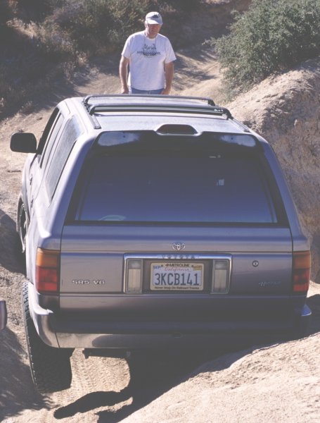
The only vehicle to get stuck on this run was a Toyota SR5. It is understandable,
all the other vehicles were Jeeps. Here,
the Toyota demonstrates the need for better departure angles. A yellow strap
quickly resolved the situation. |
|
ST-WPR N34
18.144 W117 25.981
|
It is too much fun when your Jeep stalling on every other incline.
A poor purple YJ had a wapor-lock problem,
and had to be bushed off the mountain by a group of masculine man animals. |
|
LUN 6 N34
17.846 W117 25.661
|
Mmmm... Tasty cantaloupe...
I used to think, that only pussies have cooler boxes in their Jeeps. Real
man don't need no coolers. MRIs and a supply of water is all that is needed.
But, this tasty treat that MrBlain team brings on hot days, changed my
mind... Maybe I need to get a cooler of my own... Yeah right, what's next,
paint my Jeep pink?
That's an interesting idea...
|
|
K-FAIL N34
17.685 W117 22.690
|
Look
at Clark trying to make it up one of the hills. Nop, he did not make it.
Looks like Clark is ready fro some 44 inch tires ;) |
|
DIFF N34
17.804 W117 20.844
|
The V-dich
driving, was the most technical part of the trip. Some of the participants
backed off. They got scared. 8-O Thanks to excellent spotting job by MrBlain,
little Jeep TObject completed
the section A++. |
|
AUP6 N34
18.030 W117 20.222
|
The air up lot is located just off the Hwy. 138. Reconnect the
sway bar and inspect the vehicle does it for TObject. The big boys had to
play with their CO2 balloons. |
|
RH_RSTR N33
54.843 W117 27.846
|
After the trip was over, twelve of us went to the Roadhouse
restaurant - the best stake I ever had! |
|
|
|